
.svg)
.svg)
.svg)
.svg)
.svg)
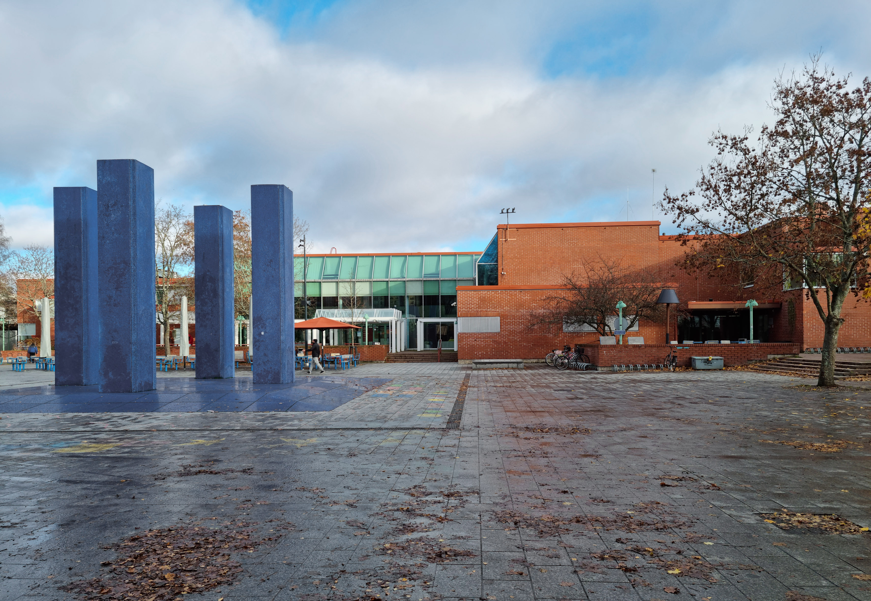
Helsingin kaupunki järjestää kulttuurikeskus Stoan perusparannuksen ja laajennuksen suunnittelusta arkkitehtuurikutsukilpailun.
Lisätietoja kilpailusta antaa kilpailusihteeri Annina Vainio, A-Insinöörit, Annina.Vainio@ains.fi
Lisätietoja kilpailusta antaa kilpailusihteeri Annina Vainio, A-Insinöörit, Annina.Vainio@ains.fi
Kulttuurikeskus Stoan perusparannus ja laajennus Kutsukilpailu
Kilpailuaika 15.1.-17.12.2026Helsingin kaupunki järjestää kulttuurikeskus Stoan perusparannuksen ja laajennuksen suunnittelusta arkkitehtuurikutsukilpailun. Kilpailun tarkoituksena on ratkaista toiminnallisesti uudistuvan ja kulttuurisesti entistä moniäänisemmän Stoan perusparannuksen ja laajennuksen arkkitehtoninen pääidea ja tilakonsepti sekä laatia kaupunkikuvallisesti korkeatasoinen suunnitelma, joka avaa ja yhdistää kulttuurikeskuksen tulevaan Stoan puistoon.Kilpailu on kaksivaiheinen. Kilpailun ensimmäiseen vaiheeseen valitaan hankintailmoituksessa ilmoitettujen kriteerien perusteella seitsemän (7) suunnitteluryhmää. Toiseen vaiheeseen kutsutaan 3–4 ehdotuksen suunnitteluryhmät.
Kaikki kellonajat ovet Suomen aikaa (talvella UTC+2 ja kesällä UTC+3).

Do the teams have to be finalized in the first phase, or can additional team members be added in the second phase?
EN 🇬🇧 Teams can be freely supplemented in the second phase. The intention is that by the second phase, the team includes a geotechnical engineer for exceptionally demanding geotechnical infrastructure design (with FISE qualifications). Additionally, the working group can be further complemented in other respects as well.
Are all the site survey documents available in English ? If yes, where can I download them from ?
Will the entries submitted in the first phase be made public? If so, will this happen before the second round or after the competition ends, and will they be accessible to the public or only to participants?
Are there any certification that the competitors much adhere to, for example LEED or ASLA?
EN 🇬🇧 Competitors are not required to have any certificates or be members of any organisations. However, as the competition programme states, at least one member of the working group must be qualified to practise landscape architecture in their country. In the second phase of the competition, the working group will also be required to include a geotechnical engineer who is qualified to design foundation structures for infrastructure projects in the ‘exceptionally difficult’ category. Any landscape construction in Helsinki must follow the Finnish framework for sustainable landscape construction (KESY). You can familiarise yourself with the KESY framework here For more on these topics, see sections 1.2 and 2.1 of the competition programme.
Is it mandatory for the working group to officially onboard a geotechnical consultant in phase one ?
EN 🇬🇧 It is not mandatory to include a geotechnical expert in the working group during the first phase of the competition, but it is recommended that a geotechnical expert with knowledge of Finnish soil conditions be involved in the team as early as possible. In the second phase of the competition, the working group must include a geotechnical engineer in exceptionally demanding geotechnical infrastructure design (FISE qualifications).
Regarding the registration requirements, could you clarify: what are the specific requirements for participating, especially a form or simply creating an acronym with the generated code?
EN 🇬🇧 No separate registration is required for the competition. Eligibility is defined in section 1.2 of the competition programme. In the first phase, at least one member of the working group must be licensed to practise landscape architecture in their country. The competition entry must be drawn up in accordance with section 6.1 of the competition programme and submitted via the competition website by the deadline. See section 6.4 of the competition programme for more detailed information on the submission of competition entries and the access code.
I suppose that the aerial image is not georeferenced (Orto_Hermanninranta 2018.tif), is there possibility get georeferenced version or the coordinates of the top left corner of the image?
EN 🇬🇧 The coordinates of the top left corner of the Orto_Hermanninranta 2018.tif image are as follows:
N: 6676709
E: 25498141.5
The coordinate system used is the following:
EPSG:3879 – ETRS89 / GK25FIN
You can also download orthophotos directly from the City of Helsinki's open WMS interface, where they are already in the correct coordinate system here
Can the proposal deviate from the detailed development plan and, for example, suggest a different location for the playground?
EN 🇬🇧 The functions indicated in the local detailed plan cannot be changed, so the playground must be located in the place specified in the plan. The entry must include a sports and recreational services area (VU), a playground (VK) and a new stormwater channel in the locations designated for them in the local detailed plan. More information on the plan symbols to be taken into account in the competition entry is provided in section 4.4 of the competition programme.
Under guidelines for entries, the brief states that the competition entry must illustrate the working groups vision. Is video format/link to video via QR code acceptable for this ?
“Ensimmäiselle planssille tulee sijoittaa asemapiirros 1:1000 taitettuna vaakatasoon siten, että pohjoinen on vasemmalla. Toiselle planssille tulee sijoittaa yksi näkymäkuva. Nämä kaksi ensimmäistä planssia tullaan julkaisemaan kilpailun nettisivuilla. Muuten kilpailija voi sijoittaa vaaditun aineiston sivuille haluamallaan tavalla. “
Voiko toiselle planssille sijoittaa muutakin kuin yhden näkymäkuvan vai tuleeko planssi varata kokonana näkymäkuvalleFI 🇫🇮 Kilpailun ensimmäisessä vaiheessa kilpailusivustolla julkaistaan kaksi ensimmäistä planssia. Kilpailijat voivat näille plansseille sijoittaa pakollisen aineiston lisäksi myös muuta materiaalia oman harkintansa mukaan. On kuitenkin hyvä huomioida, että koska kyseiset planssit julkaistaan avoimesti kilpailusivustolla, ei niille suositella sisällytettäväksi sellaista aineistoa, jonka kilpailijat toivovat säilyvän salaisena seuraavaan kilpailuvaiheeseen saakka. Lisää aiheesta kerrottu kilpailuohjelmassa luvussa 6. EN 🇬🇧 In the first phase of the competition, the first two boards will be published on the competition website. In addition to the required material, competitors may include other content on these boards at their own discretion. Since these boards will be publicly available, competitors are advised not to include any material they wish to keep confidential until the next phase of the competition. More information on this topic can be found in Section 6 of the competition programme.
In terms of formal presentation, can you clarify the presentation format or label? Is there one stipulated?
Is it possible to include descriptive text about the proposal's report and/or concept on the first page? Should it be just an image of the proposal plan at a scale of 1:1000?
EN 🇬🇧 In addition to the required material, competitors may include descriptive text and other material on these boards at their own discretion. Since these boards will be publicly available, competitors are advised not to include any material they wish to keep confidential until the next phase of the competition.
Regarding the first board, can additional diagrams or schemes be included in it?
EN 🇬🇧 In addition to the required material, competitors may also include other material on these boards at their own discretion. However, since these boards will be made publicly available, competitors are advised not to include any material on them that they wish to keep confidential until the next phase of the competition.
Are there any material restrictions?
What extension or area should the selected areas have for detailing?
EN 🇬🇧 In accordance with section 6.1 of the competition programme, the entry must include two (2) detailed plans at a scale of 1:250–1:500. The working group may choose two areas that it considers essential for its entry and present them at the appropriate scale. The detailed plans must present the same information as the 1:1000-scale general plan, but in greater detail. The images must be shaded, with the shadows coming from the southwest at a 45-degree angle.
Can any additional urban or architectural program be added to the required one if it is considered relevant and complementary to the competition’s concept?
EN 🇬🇧 In accordance with section 6.1 of the competition programme, the working group’s vision must illustrate a diverse and innovative Hermanni Waterfront Park in line with the competition objectives. The working group may also include other elements or content in the vision and competition entry that it considers relevant and complementary to the concept.
Does the requested program have specific defined areas? If so, is there any margin of flexibility to increase or decrease the intervention areas?
EN 🇬🇧 More detailed planning guidelines are provided in section 4 of the competition programme. This section specifies which functions must be included in the area and which functions are recommendations. The functions indicated in the local detailed plan, with the exception of the winter storage area for boats (vep), must be positioned in the competition area in accordance with their designated locations. The functions indicated in the detailed plan may utilise the areas designated for them in the plan to the full extent indicated in the plan.
Which program functions are mandatory, and which can be treated as flexible?
EN 🇬🇧 More detailed planning guidelines are provided in section 4 of the competition programme. This section specifies which functions must be included in the area and which functions are recommendations. The functions indicated in the local detailed plan, with the exception of the winter storage area for boats (vep), must be positioned in the competition area in accordance with their designated locations. The winter storage area for boats will be removed from the competition area. The nature and content of the functions are described in section 4.4.
How fixed are the detailed plan regulations – may the proposal suggest programmatic or spatial adjustments if they strengthen the overall vision, f.e. the designated sports area?
EN 🇬🇧 More detailed planning guidelines are provided in section 4 of the competition programme. The functions indicated in the local detailed plan, with the exception of the winter storage area for boats (vep), must be positioned in the competition area in accordance with their designated locations. The winter storage area for boats will be removed from the competition area. The nature and content of the functions are described in section 4.4.
Kilpailuohjelmassa todetaan tavoitteeksi edetä suoraan toteutussuunnitteluun, vaikka kyse on ideakilpailusta. Yleensä ideakilpailua seuraavat vielä yleis- ja puistosuunnitelmat. Millaista suunnittelutarkkuutta tässä vaiheessa odotetaan?
FI 🇫🇮 Kilpailutehtävänä on Hermannin rantapuiston toteutussuunnitteluun tähtäävän suunnitelman laatiminen. Tehtävänä on laatia puistosta yleissuunnitelma mittakaavassa 1:1000 sekä tarkennoksia suunnitelman kannalta oleellisimmista kohdista. EN 🇬🇧 The competition assignment is to draw up a general plan for the implementation of Hermanni Waterfront Park. The task is to draw up a general plan for the park at a scale of 1:1000, as well as details of the most important parts of the plan.
Mikä on vaiheiden 1 ja 2 välinen ero suunnittelutarkkuuden ja esitystavan osalta? Onko vaihe 2 tarkoitettu yksityiskohtaisempaan kehittämiseen, vai säilyykö tarkkuustaso samana kuin vaiheessa 1?
FI 🇫🇮 Kilpailussa on tavoitteena luoda puistosta yleissuunnitelma mittakaavassa 1:1000, jota tarkennetaan ja kehitetään jatkoon päässeiden osalta kilpailun 2. vaiheessa tuomariston jatkosuunnitteluohjeiden mukaisesti. Kilpailun toisessa vaiheessa lähtötiedot tarkentuvat esimerkiksi baanalinjauksen ja koulun pihan suunnittelun suhteen, joka mahdollistaa kilpailutöiden tarkemman yhteensovittamisen niiden kanssa. EN 🇬🇧 The aim of the competition is to create a general plan for the park at a scale of 1:1000, which the shortlisted competitors will refine and develop in the second phase of the competition in accordance with the jury's further planning guidelines. In the second phase of the competition, the initial data will be refined in terms of aspects such as the Baana alignment and the planning of the schoolyard, which will enable the competition entries to be coordinated more precisely with these aspects.
Is there any framework for cultural or artistic collaboration within the project (art integration, cultural programming, or cross-disciplinary initiatives)?
EN 🇬🇧 In the Kalasatama area, which also includes the competition area, a principle has been established whereby all developers in the area contribute to the acquisition of public art. Hermanni Waterfront Park will also feature public art; however, this will be included in the competition only in the second phase.
What is the overall budget range or cost level guiding the Hermanninranta park project, and will competition proposals be evaluated in relation to this?
EN 🇬🇧 No final decision has been made at this stage regarding the total budget for the park. However, in accordance with section 5 of the competition programme, the financial feasibility of the competition entries, i.e. the feasibility of the construction and maintenance costs, is one of the evaluation criteria for the entries.
In the second phase of the competition, we will request materials that will help us make a more accurate cost estimate.
Is there scope for Mirco piling ?
EN 🇬🇧 Micro piling is not recommended because the stability of the area is generally insufficient without ground reinforcement. There is also excess pore water pressure in the area, which makes piling difficult. Furthermore, the bedrock surface is mostly deep in the planning area, which also makes piling expensive.
Is micro pilling possible in the competition area ? And if so to what extent ?
EN 🇬🇧 Micro piling is not recommended because the stability of the area is generally insufficient without ground reinforcement. There is also excess pore water pressure in the area, which makes piling difficult. Furthermore, the bedrock surface is mostly deep in the planning area, which also makes piling expensive.
Is there any scope for minor land filling, if so to what percentage would be it feasible? Or is it entirely discouraged ?
Hi! There is impressive and substantial material on all the technical aspects, mostly in finnish - would it be possible to recieve an english summary and overview on the most important geotechnical conditions for the site, apart from whats written in the programme?
For soil amendments are chemical based solutions or organic additives are preferred?
EN 🇬🇧 Comprehensive data on the soil conditions across the competition area is not available, and therefore we cannot definitively recommend chemical based or organic additives as the most suitable options. In general, the aim of the competition is to use nature-based solutions on design and support local biodiversity.
Can we be provided with a detailed existing soil nutrition report containing existing nutrient levels, pH, texture and other data.
Is there any mandate or permission for uttering the water, soil, pH & nutrition levels using chemical means, or only other nature based solutions will be accepted?
EN 🇬🇧 There are no known obstacles to the use of conventional chemical methods due to the contaminated soil. Comprehensive data on the soil conditions across the competition area is not available, and therefore we cannot definitively recommend chemical based or organic additives as the most suitable options.
Are there areas where access to the sea and bathing activities are possible? Id it possible the water is not contaminated as well?
Is it possible to extend beyond the park boundary toward the sea to offer outdoor bathing activities or to restore and/or propose the dock area?
What remediation level should be assumed across the site – sensitive standards only in designated playgrounds, or a consistent high standard throughout the park? Can partial solutions such as capping or covering be accepted in less sensitive areas?
Sijaitseeko suunnittelualueella rakenteita ja materiaaleja, joita suunnitelmassa ei voida uudelleenkäyttää, esim. yksityisen omistuksen tai saastuneisuuden tai takia? (esim. kivimateriaaleja, puupaaluja, betonirakenteita)?
FI 🇫🇮 Kilpailuohjelman mukaisesti kilpailualueella sijaitsevat toiminnot poistetaan ennen puiston rakentamisen aloittamista. Alueella olevia rakenteita ei ole inventoitu eikä niiden huomioiminen suunnitelmissa ole tarpeen. Maassa saattaa olla purkutoimenpiteiden jäljiltä rakenteita, kuten paaluja, joita ei kuitenkaan tarvitse poistaa. EN 🇬🇧 In accordance with the competition programme, the functions located in the competition area will be removed before the construction of the park begins. The structures in the area have not been inventoried, and it is not necessary to take them into account in the plans. There may be structures, such as piles, left behind after the demolition work, but these do not need to be removed.
Onko pilaantuneiden maiden poistotarpeesta tarkempaa suunnitelmaa? Suunnittelualueella on useita kynnysarvon ylittäviä ja vaarallisen jätteen raja-arvon ylittäviä tutkimuspisteitä. Onko näitä tarpeen puhdistaa, jos näille alueille ei sijoiteta uusia rakenteita?
FI 🇫🇮 Pilaantuneen maan puhdistamisesta ei ole vielä suunnitelmaa. Kunnostustavoitteet määritetään riskinarvion avulla. Todennäköisesti syvemmällä olevat haitta-ainepitoiset massat voidaan jättää paikoilleen, jos niitä ei rakentamisen vuoksi tarvitse kaivaa. EN 🇬🇧 There are no plans yet for cleaning the contaminated soil. The remediation targets will be determined through a risk assessment. It is likely that deeper layers containing harmful substances can be left in place if they do not need to be excavated for construction purposes.
Miten pilaantuneiden maiden osalta toimitaan? • Olevaa kasvillisuutta ei voi säilyttää, jos pilaantuneet täyttömaat joudutaan vaihtamaan • Nykyinen veneiden talvisäilytysalue poistuu. Tuleeko pintarakenteiden purkamisen yhteydessä ottaa kantaa pimoihin?
FI 🇫🇮 Kunnostustavoitteet määritetään riskinarvioinnin avulla ja hyväksytetään ympäristöviranomaisella. Oletettavasti ainakin osa maa-aineksesta joudutaan poistamaan tai eristämään esim. peittämällä. Kilpailuun ei sisälly kunnostustavoitteiden määrittäminen eikä pilaantuneen maaperän puhdistamisen suunnittelu. EN 🇬🇧 The remediation targets will be determined through a risk assessment and submitted to the environmental authority for approval. Presumably, at least some of the soil will have to be removed or isolated by covering it, for example. The competition does not include setting remediation targets or planning the cleanup of contaminated soil.
Are there opportunities for safe and controlled water play or human–water interaction (although no bathing), or should public access to water be avoided entirely due to soil and water contamination?
Regarding materials, are there any restrictions on what materials can be used? Is it possible to use expanded polystyrene?
EN 🇬🇧 Any soil fillings must not contain materials that could alter soil conditions (e.g. pH) in a way that increases the migration of harmful substances. When using expanded polystyrene, the effect of buoyancy must be taken into account, especially if the material is intended to be used as a lightening material.
Is is advisable to remove invasive plant species and if so what is the advisable method to remove them ?
EN 🇬🇧 Invasive alien species (IAS) listed on European Union’s the List of species of Union or national concern (latest update 15.8.2023 (912/2023)) may not be cultivated, sold or marketed in Finland. Releasing these species into the environment is prohibited, and any existing populations must be removed.
According to Alien species strategy of Helsinki (2022), harmful alien species should be eradicated during construction projects. However current legislation does not mandate their control. National guidelines for prevention and management of invasive can be found at vieraslajit
The City of Helsinki maintains a list of species currently regarded as invasive and harmful, detailed in Haitalliset vieraskasvit, joita ei istuteta - Helsingin kaupunkikasviopas For the implementation phase, the city provides guidance cards that give instructions on the eradication of invasive species.
The aim is to reduce the number of harmful invasive species through control and maintenance, using methods such as excavation, cutting, or covering, which help weaken the species and their populations.
The design solutions planned for the competitions site will determine which control methods are most appropriate. Control efforts may need to continue over extended periods to fully remove invasive populations. Soil and plant waste generated during eradication must be disposed of in accordance with current regulations.
Links:
Helsingin kaupungin haitallisten vieraskasvien ja -etanoiden torjunnan priorisointisuunnitelma
Haitalliset vieraskasvit, joita ei istuteta - Helsingin kaupunkikasviopas
Note: The linked documents and webpages are available only in Finnish
Are there any migrating bird species identified on site ?
EN 🇬🇧 Most of the bird species in the area are migratory. The open parts of the site provide suitable habitat for grazing goose species such as barnacle goose (Branta leucopsis) and Canada goose (Branta canadensis), both of which are abundant in Helsinki Dense shoreline vegetation supports a variety of insectivorous bird species. On a typical spring day, around 100 bird species can be observed on site, the majority being migratory. In winter, approximately 10–15 species are likely to be present.
Are detailed maps, plans, or markup data available that specifically demarcate the current key areas and potential temporary spots for bat species to feed and breed bifurcate?
EN 🇬🇧 A bat survey was conducted in the area in 2024. Report of this survey (in Finnish) is included as competition programmes as appendix no 10. On the page 10 of this report, you can find key findings regarding locations of the observations of the two most common species (Eptesicus nilssonii & Myotis daubentonii). The most suitable habitat for bats is marked with purple.
Are there any constraints for eradicating the invasive species on site?
EN 🇬🇧 Invasive species must be eradicated according to European Union’s the List of species of Union or national concern (latest update 15.8.2023 (912/2023) and City of Helsinki’s alien species strategy (2022).
The aim is to reduce the number of harmful invasive species through control and maintenance, using methods such as excavation, cutting, or covering, which help weaken the species and their populations.
The design solutions planned for the competitions site will determine which control methods are most appropriate. Control efforts may need to continue over extended periods to fully remove invasive populations. Soil and plant waste generated during eradication must be disposed of in accordance with current regulations.
Helsingin kaupungin haitallisten vieraskasvien ja -etanoiden torjunnan priorisointisuunnitelma
Haitalliset vieraskasvit, joita ei istuteta - Helsingin kaupunkikasviopas
Note: The linked documents and webpages are available only in Finnish
Is a CAD survey or GIS map available that accurately demarcates the boundaries of the identified vegetation, biotopes or clumps?
EN 🇬🇧 In the Vegetation survey (2025), the area’s habitats have been divided into three main categories: shoreline habitats, meadow-like areas, and wooded areas. This categorization illustrates the presence of distinct and interesting biotopes within the area and serves as background information for the competition. However, the boundaries are partly interpretative and the entire competition area has not been marked with precise boundaries. This should be taken into account when using the information. The competitors may adjust and define the boundaries, for example, by using aerial images. The vegetation survey will be included in the competition’s background materials for participants’ use.
Is the vegetation survey further bifurcated into seasonal changes, flowering seasonal, colour, species ? fruiting seasonal changes, colour, and species?
Is there any area of the site that shows 0% growth of vegetation and has remained completely barren for years, even when kept untouched or unused?
If key feeding areas are mapped, are there specific details of the tree species, shrubs, or other fruiting and flowering habitat that the bats utilize for feeding?
Can we be provided with documentation regarding the site's compliance or status relative to Annex IV of the EU Habitats Directive and Section 78 of the Nature Conservation Act?
Has a review been conducted to confirm that none of the existing plant, tree, shrub, or herb species on site are classified as Rare, Endangered, or Threatened under the national red list or any relevant international (e.g., IUCN) conservation list? Does this confirm the mandatory protection status of flora?
Based on regional data, what are the typical peak seasons or months when maximum bat activity (movement or migration) occurs in the Helsinki area.
Are there any existing detailed tree survey plans or layout maps that show the location, species, and health status of individual trees?
EN 🇬🇧 There is no detailed tree survey that shows location, species or health status of individual trees. Wooded areas have been invented as biotopes in plant inventory conducted in 2024. The survey is available on the competition website under the downloadable materials section as Appendix 9. Vegetation survey.
What are the observed maximum hrs, days, weeks, months bats stay on pockets of our site ?
Has any fish inventory or biological monitoring been conducted in the area, and if so, are there key findings that should inform the design of the waterfront?
EN 🇬🇧 Fish monitoring using gillnets is conducted biennially in Vanhankaupunginselkä Bay. The fish community in the area is characteristic of sheltered, eutrophic bays of the Baltic Sea, with a relatively high biomass of cyprinid species. In addition, Vanhankaupunginselkä Bay has been identified as an important spawning ground for predatory species such as European perch, zander, and northern pike. These spawning sites are primarily located outside the competition area, along the northern and eastern shores of the bay. However, a pond within the competition area that connects to Vanhankaupunginselkä Bay serves as a smaller-scale spawning habitat for cyprinids and sticklebacks. The bay also functions as a vital waterway for anadromous species that spawn in the Vantaanjoki River, including sea trout, Coregonus lavaretus, and European smelt.
Are there any known or monitored occurrences of invasive plant or aquatic species within the site, particularly in the strand or wetland zones?
EN 🇬🇧 The Vegetation survey (2025) lists the invasive plant species observed within each biotope. The inventory does not include underwater habitats. Competitors may also access observations of invasive alien species as geographic data through Helsinki Map Service
What is the quality of water of the surrounding bay area, is there any data for its PH levels and contamination?
EN 🇬🇧 The water quality in Vanhankaupunginselkä Bay is deteriorated, with both ecological and chemical status classified as poor. As a river estuary, the bay is heavily influenced by the water quality of the Vantaanjoki River. The river’s extensive catchment area contributes to high loads of turbid water, nutrients, and harmful substances. The pH of the water typically ranges between 7 and 9, depending on the season. Studies have found significant concentrations of harmful substances in fish from the bay, and available data indicates contamination in both the water and sediment. Water quality is monitored year-round by the Environmental Services of the City of Helsinki. All data is stored in the VESLA system (Information System for the Status of Surface Waters), which is available only in Finnish. Link to notice on contaminated fish (PDF) https://www.hel.fi/static/liitteet/kaupunkiymparisto/asuminen-ja-ymparisto/elintarvikevalvonta/kalaselvitys-en.pdf
Are there recent measurements or data available on water quality in the Hermanninranta area — for example nutrient levels, oxygen concentration, or contaminants in the water?
EN 🇬🇧 Water quality in the Hermanninranta area, which is part of Vanhankaupunginselkä Bay, is monitored year-round by the Environmental Services of the City of Helsinki. All data is stored in the VESLA system (Information System for the Status of Surface Waters), available only in Finnish. The ecological and chemical status of the water in Vanhankaupunginselkä is poor. The bay is strongly affected by the Vantaanjoki River, whose large catchment area results in high nutrient and contaminant loads. Annually, the river contributes approximately 1,268 tons of nitrogen and 69 tons of phosphorus to the bay. Despite the contamination, the water is generally well oxygenated, with an average oxygen saturation of 96%. Seasonal variations affect water quality parameters. Harmful substances have also been detected in fish from the area, and both water and sediment show signs of contamination. Link to notice on contaminated fish (PDF) https://www.hel.fi/static/liitteet/kaupunkiymparisto/asuminen-ja-ymparisto/elintarvikevalvonta/kalaselvitys-en.pdf
Is there a need for any water treatment for the stormwater channel ? If so will it be feasible ?
EN 🇬🇧 Qualitative treatment of stormwater before discharging it into the sea is recommended. However, when planning treatment solutions, it is important to take into account the contaminated soil in the area. Any additional absorption of stormwater and the discharge of water into the contaminated soil must be avoided. The stormwater channel to be built in the area will be isolated from the contaminated soil by means of special isolation solutions.
What is width of the current stormwater channel and the force of water discharged ?
Kuinka kauan tulvavesi viipyy alueella eli kauan kestää, että vesi suotautuu maaperään?
FI 🇫🇮 Alueella on paksut savi- tai liejukerrokset, joiden päällä on sekalaista täytemaata. Savi- ja liejukerroksiin vesi ei imeydy ja täytemaakerroksissa veden suotautumisnopeutta on vaikea arvioida, koska materiaali on hyvin sekalaista. Pohjatutkimuksia alueella on tehty, mutta niiden perusteella ei voida arvioida veden suotautumisnopeutta. EN 🇬🇧 The area has thick layers of clay or mud, covered with mixed fill soil. The clay and mud layers do not absorb water, and it is difficult to estimate the rate of water infiltration in the fill layers because the material is very mixed. Soil surveys have been conducted in the area, but they do not provide a basis for assessing the rate of water infiltration.
Onko suunnittelualueen ulkopuolella suunnitteilla tai jo rakennettu viivytyksen lisäksi hulevesiä puhdistavia rakenteita?
Is it correctly understood, that only rainwater runoff from the surrounding build areas should be isolated from infiltrating the soil - but that it would be ok to infiltrate seawater and rain that falls locally within the site?
EN 🇬🇧 Stormwater collected from the surrounding new residential areas will be directed to the new stormwater channel, which will be isolated from the contaminated soil. The new stormwater channel must delay and purify stormwater before discharging it into the sea. There is no need to specifically prevent the natural absorption of floodwater or rainwater that falls locally in the area.
The competition area overlaps with the existing design for Hermanninranta – is it therefore acceptable to propose a revised design in the border zone?
EN 🇬🇧 Hermanninterassi (Hermanni Terrace) will be built above the flood level, and the area between it and the waterfront park will be designed as a sloping solution. The competition area borders the lower edge of the Hermanninterassi slope. This means that the planning of the Hermanninterassi is not part of the competition, but submission entries must be compatible with the plans for the Terrace.
Given that it is being adapted to pre-existing designs for the new urban area, what flexibility can the proposed design of the terrace strip (transition spaces between the development and the park) have to be redesigned in accordance with the WaterFront Park proposal?
The competition boundary runs partly through the slope between Hermanni Terrace and the park, while the program states that the slope belongs to the terrace. Should the competition proposal include the slope in its design, or treat it as a fixed condition defined by Stage 1 Asemakaava?
Are there technical requirements from Asemakaava’s presentation of the terrace that must be respected?
Stage 1 of the development is more detailed and technically defined, while Stage 2 (the northern part of the site) is less developed. Should Stage 2 be treated as a flexible framework for future connections and open scenarios, or should it already now be integrated into a more defined structure?
EN 🇬🇧 The competitors must follow the delineation of the Hermanninterassi (Hermanni Terrace) reference plan in the park plan bordering the northern section of Hermanninterassi for which no detailed plans have yet been drawn up. However, when it comes to the sloping transition area, competitors have more freedom to develop ideas and propose design solutions. The reference plan for Hermanninterassi is presented in Appendices 2 and 7.
”Hermanninterassi rakennetaan tulvakorkeuden yläpuolelle ja Hermanninterassin ja rantapuiston välinen alue toteutetaan rinnemäisenä ratkaisuna.” Mille tulvakorkeudelle Hermanninterassi rakennetaan? Sivulla 19 (Kuva 13. Kilpailualueen toiminnot) alin korko on tasolla +3,2
FI 🇫🇮 Hermanninterassin korot vaihtelevat +3,2 ja +4,7 m välillä. Suunnitelmat tulee sopeuttaa kilpailuohjelman kuvassa 13 annettuihin korkotasoihin ja liitteessä 6 annettuihin Hermanninterassin rinteen korkotasoihin. EN 🇬🇧 The elevation of the Hermanninterassi ranges between +3,2 and +4,7 m. The plans must be adapted to the elevation levels shown in Figure 13 of the competition program and to the slope elevations of the Hermann terrace provided in Appendix 6.
Mille korolle VU ja VK alueet tulee rakentaa? Kilpailuohjelmasta: ”Urheilu- ja virkistyspalveluiden alue ja leikkipuisto on suunniteltu sijoitettaviksi lähelle kaupunkirakennetta puiston länsilaitaan, jotta ne voidaan nostaa korkotasoltaan ylemmäksi suojaan useimmin toistuvilta tulvilta.”
FI 🇫🇮 VU ja VK alueille ei ole vielä määritelty tarkkoja korkotasoja. Jotta alueet olisivat suojassa useimmin toistuvilta tulvilta, niiden tulee olla ylempänä kuin +2.8 m. EN 🇬🇧 Specific elevation for the VU and VK areas have not yet been determined. To ensure that these areas remain dry during the most frequently occurring floods, they should be designed at an elevation of +2.8 m or higher.
Mikä tulee olla tulvien kannalta Rannan pääreitin ja pienempien reittien palvelutaso (kuinka usein saavat tulvia)? Kilpailuohjelmasta: ”Rannan pääreitti ja uudemmat pienemmät reitit saavat aika ajoin jäädä tulvan alle.”
FI 🇫🇮 Kilpailuohjelman mukaisesti rannan pääreitti ja uudemmat pienemmät reitit saavat aika ajoin jäädä tulvan alle. Näiden reittien palvelutason ei siis tarvitse olla sellainen, että ne pysyvät jatkuvasti kuivina, vaan tulvien satunnainen esiintyminen on hyväksyttävää.
Tulvien esiintymisen vaihtelusta on kerrottu tarkemmin kilpailuohjelman kohdassa 4.9 sekä liitteessä 12. Kilpailijoiden odotetaan ratkaisevan tulviin liittyviä haasteita kilpailuehdotuksissaan.
EN 🇬🇧 In accordance with the competition programme, the main route and newer, smaller routes are allowed to be flooded from time to time. The service level of these routes does not need to be such that they remain dry at all times; occasional flooding is acceptable.
More detailed information on the variation in flood occurrence is provided in section 4.9 of the competition programme and in Appendix 12. Competitors are expected to address the challenges associated with flooding in their entries.
Will it be possible to raise certain structures as much as or above 3.3m on the competition area? For example the Banna route
EN 🇬🇧 It is possible, but will probably require ground reinforcement measures that may be difficult and expensive to implement. The feasibility of embankment filling must be examined in more detail on a case-by-case basis during further planning at the latest. However, occasional flooding of the Baana is acceptable in the waterfront park, so it is not necessary to raise the ground level to +3.3 on its account.
Are there any height restrictions in case a lookout or viewing structure is proposed?
EN 🇬🇧 The competition brief does not set any restrictions on structure heights. However, the area’s challenging soil conditions and their implications for construction must be taken into account. Section 4.6 of the competition brief (‘Geotechnical Conditions’) provides recommendations concerning structures and foundations.
What is the desired ratio of softscape vs hardscape for the competition outcomes for phase 1 ?
Are there any canoeing points currently on site or in the vicinity? Is there a requirement to store boats at the site for canoeing specifically ?
Onko lisätietoja veneenlaskupaikan toiminnoista, mitoituksista ja tilavarauksista? Onko rakenteet säilytettävä vai voiko niitä muokata?
FI 🇫🇮 Alueen veneenlaskupaikan ja rantapuiston suunnittelussa tavoitteena on tukea kevyttä veneilyä, erityisesti soutu- ja melontatoimintaa. Veneiden laskuun voidaan esittää ramppi, joka soveltuu trailerilla tuotaville ja veteen laskettaville veneille. Lisäksi voidaan ehdottaa esimerkiksi muita vesillä liikkumista tukevia rakenteita, kuten venevalkamaa, melontalaituria sekä varusteiden säilytys- ja käyttötiloja rannassa. Mitoitus ja tilavaraukset tulee esittää kilpailuehdotuksessa valitun konseptin mukaisesti. Nykyisen betonirakenteisen nostolaiturin osalta voi ehdottaa muutakin käyttöä, mikäli alueella ei enää säilytetä veneitä talvisin eikä laiturilta näin ollen tehdä jatkossa raskaita nostoja. Ehdotuksissa voidaan esittää rakenteiden muokkaamista palvelemaan kaupunkilaisten muuta virkistyskäyttöä. EN 🇬🇧 The boat launch site and waterfront park should be designed to support light boating, particularly rowing, canoeing and kayaking. For boat launching, there may be a ramp suitable for boats transported on trailers and launched into the water. In addition to this, other structures that support water transport can be proposed, such as a boat harbour, a canoe and kayak pier, and equipment storage and usage facilities on the shore. Dimensions and space allocations must be presented in the competition entry in accordance with the selected concept. Other uses can be proposed for the existing concrete lifting dock if boats are no longer stored in the area during the winter and the dock is therefore no longer used for heavy lifting. Entries may include adapting the structures to serve other recreational purposes for the city's residents.
Vaativatko satamatoiminnot muita kiinteitä rakenteita suunnittelualueelle kuin veneenlaskupaikan, ajoyhteyden sekä puiston eteläkärkeen suunnitellun rantamuurilla rajatun pysäköintialueen? Toteutetaanko satama muuten kelluvilla rakenteilla? Miten lähelle rantaa kelluvat rakenteet sijoittuvat? Löytyykö satamasta pysäköintialueen lisäksi muita suunnitelmia?
FI 🇫🇮 Alueelle toivotaan monipuolisia veneilyn, muun vesillä liikkumisen sekä muita merellisen virkistyksen mahdollistavia rakenteita. Ehdotuksissa voidaan vapaasti esittää tämän tavoitteen mukaisesti toimintoja sekä rakenteita asemakaavan määräykset huomioiden. Vesialueelle sijoittuvat satamarakenteet toteutetaan lähtökohtaisesti kelluvina. EN 🇬🇧 The area should be equipped with a variety of structures for boating, other water transport and other forms of marine recreation. Entries may freely present functions and structures in line with this objective, taking into account the provisions of the local detailed plan. Harbour structures located in the water area will, in principle, be constructed as floating structures.
Are there any surveys or studies on the community's perception of the area?
EN 🇬🇧 The Hermanninranta residential area is still under construction, and no resident surveys or similar interactions have been conducted regarding the park so far. The actual interaction regarding the park plans will take place during the second phase of the competition. At the end of the second phase, the competition entries will be published on the Kerrokantasi service, where residents and other users can provide feedback and comments.
Do you have demographic and sociocultural statistics regarding the ethnicities, family types, etc., that are projected to reside in the new neighborhoods surrounding Hermannin WaterFront Park, for international comperitors can use and have in mind?
EN 🇬🇧 The construction of the Kalasatama area began in 2009, and the area is expected to be completed in the early 2040s. The area currently has a population of around 12,000, which is expected to grow to around 32,000 by the 2040s. Population growth is steady, at around 1,000 residents per year.
Hermanninranta, located in the northern part of Helsinki's Kalasatama district and bordering the competition area, will be a residential area with services and a population of approximately 5,500. In addition to Hermanninranta, plans are underway to develop the Kyläsaari area, which will also be a service-oriented residential area for approximately 5,000 new residents.
The area has a diverse population structure and all forms of housing production. Housing prices in Kalasatama are approximately 25% higher than the average housing prices in Helsinki.
The open statistical databases in the Helsinki Region allow you to view population data for Kalasatama, but these are only available in Finnish. Links to the tables:
Households table
Education level, age and gender table
Family type table
Native language and age table
Household income by life stage table
Has there been any citizen dialogue connected to the Hermanninranta park planning process? If so, are there any key findings or insights that should inform the competition proposals?
EN 🇬🇧 The Hermanninranta residential area is still under construction, and no resident surveys or similar interactions have been conducted regarding the park so far. The actual interaction regarding the park plans will take place during the second phase of the competition. At the end of the second phase, the competition entries will be published on the Kerrokantasi service, where residents and other users can provide feedback and comments.
Kilpailijoita kehotetaan jättämään ehdotuksensa järjestelmään hyvissä ajoin ennen määräajan päättymistä. Järjestelmään voi palauttaa myös keskeneräisen version, jolloin kilpailija saa henkilökohtaisen pääsykoodin. Tämän koodin avulla ehdotusta voidaan täydentää ja muokata kilpailuajan puitteissa.
Kilpailijan on säilytettävä saamansa pääsykoodi huolellisesti, sillä ainoastaan sen avulla ehdotusta voidaan muokata määräajan sulkeutumiseen saakka. Pääsykoodi sisältyy myös talletusten yhteydessä selaimen kautta latautuvaan PDF-tositteeseen.
Viimeisin talletettu versio katsotaan määräajan sulkeutuessa palautetuksi kilpailuehdotukseksi.

